Overview
In close proximity to the Chevron oil refinery in Richmond, Point Molate Beach was closed in 2001 and only reopened last month. The Richmond city council allocated a portion of the settlement received from the 2007 Cosco Busan oil spill to fund the park improvements. While this park is just north of the San Rafael bridge where tens of thousands of commuters drive every day, it is hidden and in some ways unspoiled.

Point Molate Beach
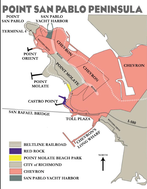
.Point San Pablo along with Point San Pedro in Marin County, defines the San Pablo Straits separating San Francisco and San Pablo Bays.
The majority of land on the San Pablo Peninsula is owned by Chevron, with their refinery operations on the east side of the San Pablo Peninsula ridge.

Ferry cruises up San Pablo Bay from San Francisco towards Vallejo. Beats 35 miles of traffic jams!
Waves from the ferry have helped create a five foot bank behind the beach.
Nesting Osprey  In late April, the guard at the Chevron gate said that moma osprey had just started sitting on her nest. She originally starting building her nest in an unsafe spot near some power wires. A nest was built for her here, but she dismantled it piece by piece and rebuilt according to her own specifications.
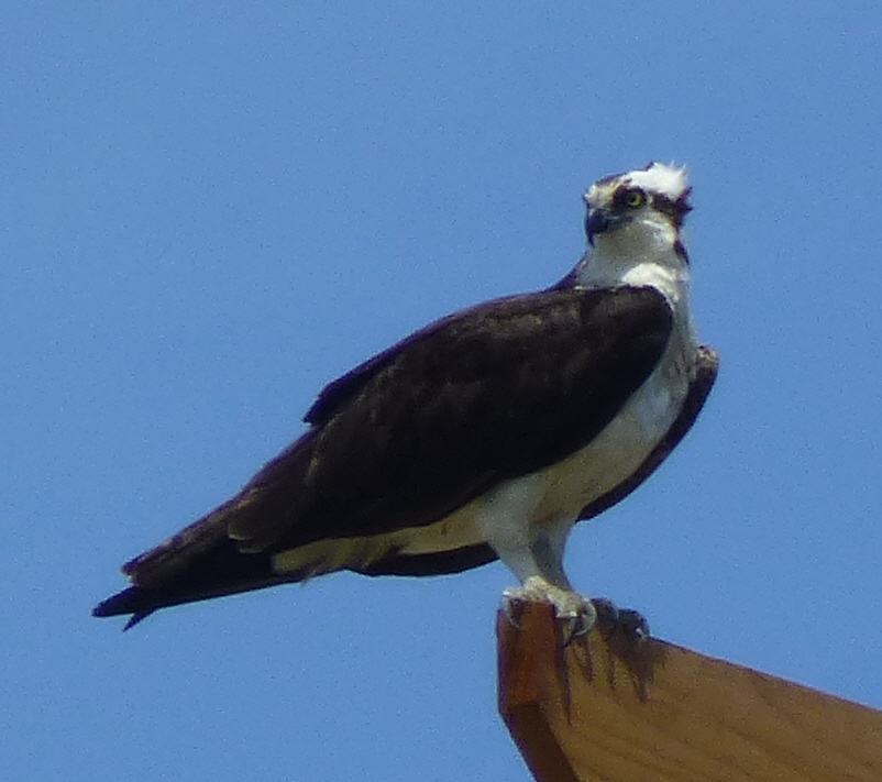

Point Molate Osprey Nest
Osprey first began nesting in the San Francisco Bay Area in the year 2000, having moved their nesting range further south. >Ospreys go south for the winter and spend the breeding season in higher latitudes. In the past, they would pass up the San Francisco Bay to nest farther north.
Since 2008 they have been nesting at Pt. Molate and this year there are 6 active nests along Richmond’s shoreline. Osprey nests are currently active atop the Whirley Crane and near the Red Oak Victory at Terminal 3 in Richmond, and at Pt. Orient just north of Pt. Molate. There are two nests at Pt. Molate – one out on Pt. Molate pier, and one just north of Pt. Molate Beach.

Moma Osprey, I could only see a flash of white, but upon enlargement, it became clear she was checking me out
The parents begin arriving and building nests in late February, with incubation starting in late March. The first young hatch at the beginning of May, and in late July they begin fledging, or flying for the first time.
The ospreys are usually on top of dead, open-topped trees or on manmade structures like cranes and lampposts, which they find convenient platforms for their extensive nests. That makes this species one of the few that can adapt well to densely urbanized habitats.
Experts don’t know why ospreys have started nesting on the bay, but have seveal theories:
- The Bay has grown clearer in recent years, the turbidity from the upriver placer mining of more than a century ago having finally settled, leaving the waters clearer and – likely – easier for ospreys to fish in.
- Ospreys may be spreading down from the Kent Lake colony in Marin, which was first noted in the 1960s and has since grown substantially. There are two parts to that particular theory; it may be that the ospreys are simply moving due to space constraints, but it is also possible that the recent appearance of nesting bald eagles at the lake may have upset the osprey population, inspiring its bay-ward move.
- The recent ecological restoration of the Napa River may be playing a role.
- Osprey populations from farther north may have grown to such an extent following the ban of DDT that as they migrate over the San Francisco Bay they are choosing to stay.

Fishing duties will be up to dad for the duration
Grasses
Point Molate has some of the last undisturbed grasslands along the east shore of San Francisco Bay. Some of the areas on the Chevron property have been ravaged by goats, but the goats are gone now and were never a presence by the shore.
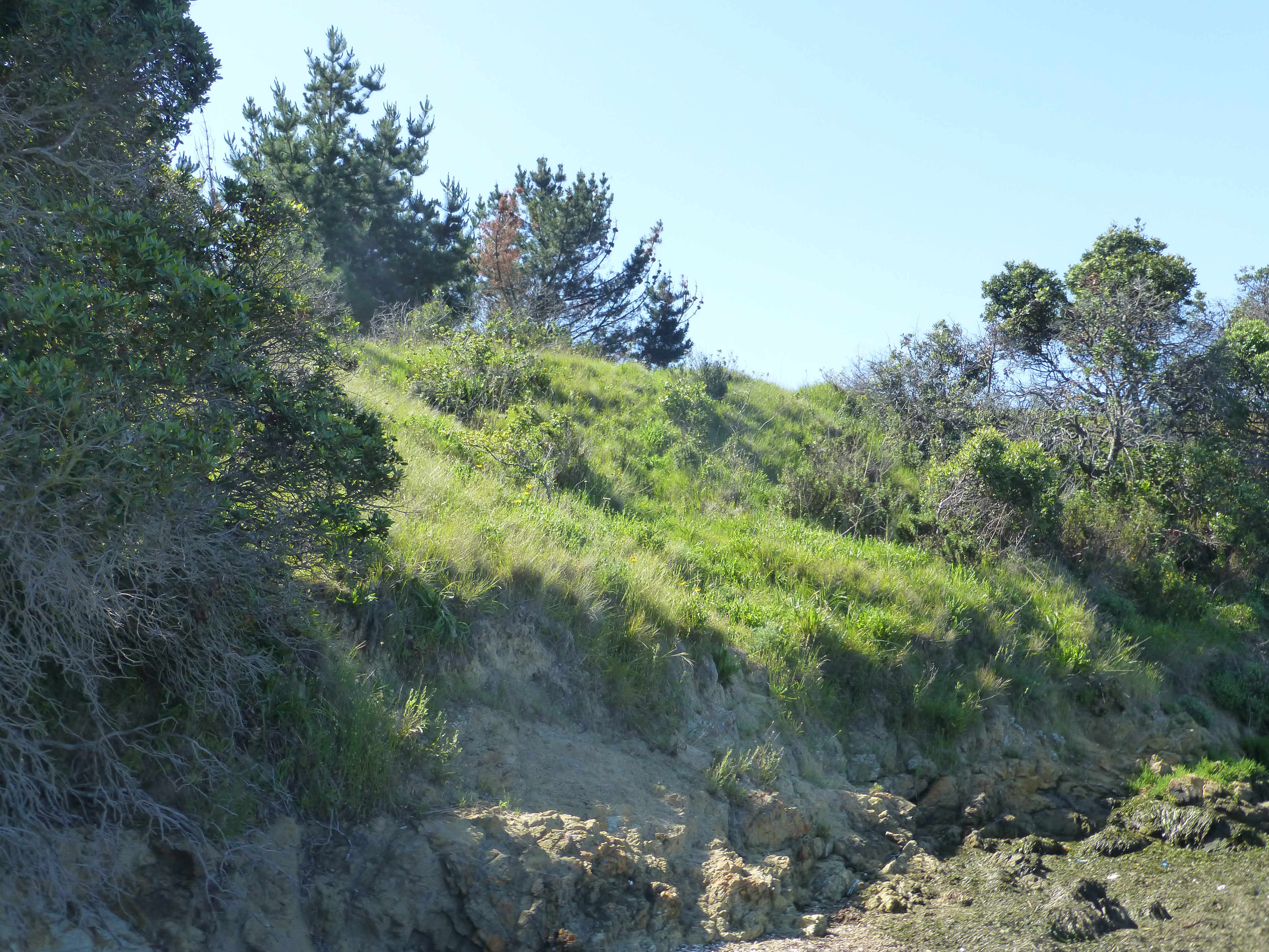
Point Molate Grasslands
Herbs and Vines
Dichondra donelliana – Also called California Ponysfoot. An uncommon native Dichondra. it has great potential as a ground cover. We had a dichondra lawn growing up. Bet you didn’t know there was a California native species. Also found on the eastern slopes of Mt. Tam.

Dichondra donelliana. It is an uncommon native Dichondra, I think it has great potential as a ground cover.
Dudleya farinosa – Also known as powdery liveforever, north coast dudleya, Sea Lettuce, or Bluff Lettuce. A now rare succulent of the coastal bluffs. Most most of this has be taken over the years by succulent addicts. Mostly along the coast Mendocino to Monterrey counties.

Dudleya farinosa
Flowers
Wyethia angustifolia

Wyethia angustifolia narrow leafed mule ears

Lupine
History
Built in 1908, the Winehaven winery was the largest in the US and maybe the world before it was closed down by prohibition. After the 1906 earthquake left San Francisco in ruins, the California Wine Association moved to Point Molate. At the peak of the season as many as 400 workers lived here, as all of the California Wine Association’s shipments to foreign, coastal and New York markets sailed from the Winehaven dock–shipment capacity was 500,000 gallons a month, and 40 ships sailed annually for New York alone.
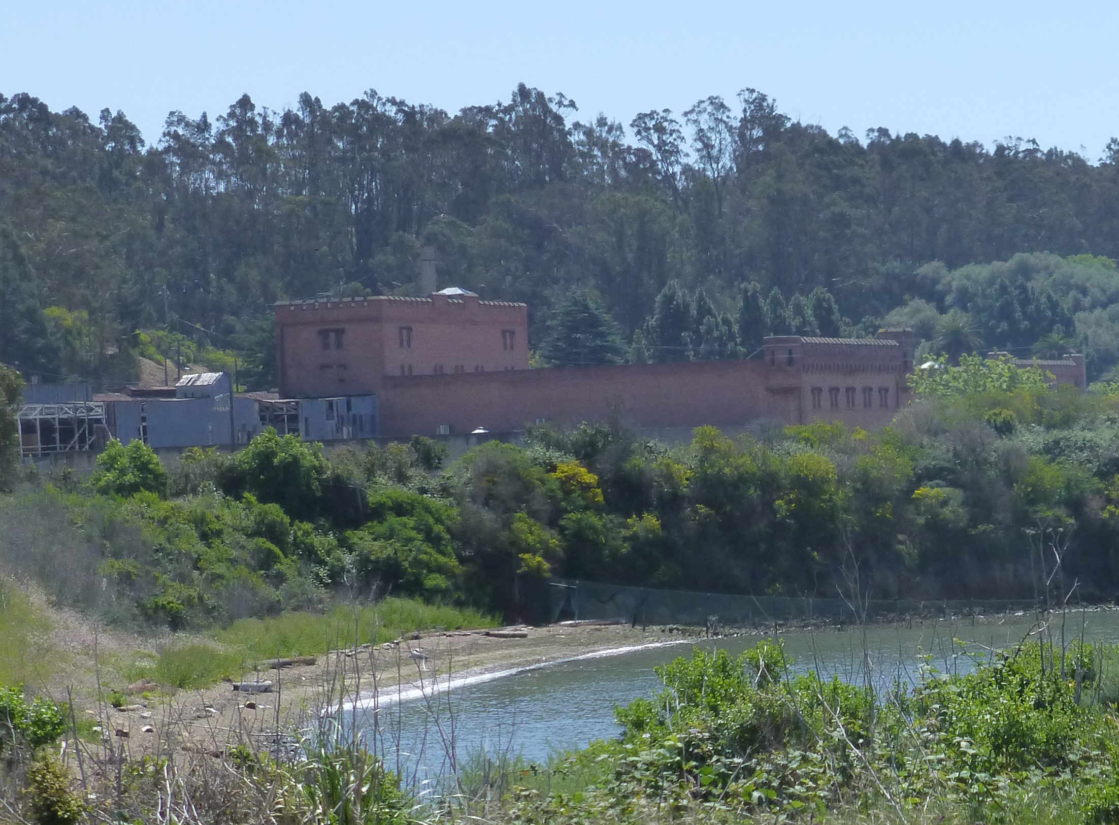
WInehaven Winery
Prior to WWII, visitors to Winehaven; which had become a tourist destination after its closing, enjoyed afternoons picnicking and swimming at Point Molate beach.
During both WWII and the Korean War, when the Navy Fuel Depot was in full swing, there was no recreating in the waters off Pt. Molate. Floating on the shallow waters was a permanent oil slick deterring bathers and swimmers. The Navy developed a system of sump ponds at Pt. Molate to collect oil and fuel to prevent runoff into the Bay. By the early 1960’s the waters off Pt. Molate had been successfully cleaned up, opening the area to recreation again.
Links
- http://www.pointrichmond.com/pointsanpablo/pointmolate.htm
- Citizens for a Sustainable Point Molate
- Claire Mathieson “Ospreys taking a liking to San Francisco Bay” Bay Nature, Sep 11, 2013
- Point Molate Beach Restoration Project (PDF)
- Point Molate Community Advisory Committee – works with the City Council, staff and other citizen advisory boards and commissions to provide advice and input on all Point Molate matters; that reviews proposed Point Molate development budgets with City staff; and that makes Point Molate development expenditure recommendations, in conjunction with staff, to the City Council.
