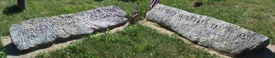
In 1695 at the age of 74, Rev. James FITCH (1622 – 1702) founded and settled Lebanon, Connecticut, a new town nearby Norwich where he lived. He moved to Lebanon in 1701 when he retired from the church in Norwich. He remained in Lebanon until his death at age eighty on November 18, 1702. He is buried at the churchyard there and his stone remains in the old cemetery.
The town of Lebanon has its origins with the settlers of Norwich, who wanted to expand beyond the “nine miles square” they had bought from the Mohegan sachem Uncas. In 1663, the first grant in the area was given in to James’ father-in-law Maj. John Mason, deputy governor of the Connecticut colony; the next year, Mason accepted 500 acres northwest of Norwich. This area, known as “Pomakuck” or “Pomocook” by the Mohegans, is now the Goshen Hill area of Lebanon. In 1666, Connecticut granted an additional 120 acres to the Rev. James Fitch, minister of Norwich, adjacent to Maj. Mason’s land which was now known as Cedar Swamp. The Mohegans conferred their blessing on the grants by giving an additional seven-mile strip to Maj. Mason’s son in 1675, who split the land with the Rev. Fitch, his father-in-law. This area is now known as “Fitch and Mason’s Mile,” or just “The Mile.”

Mr. Fitch's Mile
Mr. Fitch’s Mile
Lebanon, Connecticut, a mere dot on a road map of that state, is an attractive New England town noted for its mile-long Common. The town lies just to the northwest of Norwich and has its origins in the expansion of Norwich residents to land beyond the “nine miles square” they had bought from the Mohegan sachem Uncas. The first grants in the area were given in 1663 to Maj. John Mason (ca. 1600-1672), deputy governor of the Connecticut colony, and in 1668 to Rev. James Fitch (1622-1702), minister of Norwich. These two men were doubly connected by marriage. Rev. Fitch’s second wife was Mason’s daughter Priscilla, and John Mason, Jr. married Abigail Fitch, the minister’s daughter by his first wile, Abigail Whitfield (for some notable descendants of Rev. Henry Whitfield, founder of Guilford, Connecticut, and his wife Dorothy Sheafe, parents of Abigail, see NEXUS10[1993]:71, 74). Maj. Mason and Rev. Fitch were also among the founders of Norwich. The grants were in the southwestern part of what is now Lebanon, an area the Indians called Pomakuck, and lay between Deep River and Goshen Hill. Fig. 1 is a reconstructed map of the area, based on maps in G. McL. Milne, Lebanon (1986), p. 6.
The next significant grant was a strip of land a mile wide and about six miles long on the Norwich border; this land became known as “Mr. Fitch’s Mile,” “the Fitch and Mason,” or just “The Mile.” Then, in 1692, four Norwich men bought a large tract from Owaneco, one of the sons of Uncas; this area was called the “Five Miles Square” or simply the “Five Mile.” The dashed line represents the Owaneco grant; the solid outer perimeter is the present Lebanon boundary. The Lebanon Historical Society has even located a 1693 corner marker known as the “Five Mile Rock” at the southwest corner of the tract.
Traditionally, it has been thought that, a few years before selling the “Five Mile,” Owaneco had given the “Mile” to Rev. Fitch. As Frances Caulkins wrote in History of Norwich, Connecticut (1873) following the description of James Fitch’s Pomakuck grant:
To this grant, Owaneco, the son and successor of Uncas, at a subsequent period, in acknowledgement of favors received from Mr. Fitch, added a tract Five miles in length and one in breadth. This munificent gift was familiarly called the Mile, or Mr. Fitch’s Mile.
Others have repeated this story: notably, Rev. Orb D. Hine in Early Lebanon (1880) (pp. 9-10); the 1986 town history cited above; and Robert Charles Anderson, who in a master’s thesis on the settlement of Lebanon cited a 1687 Norwich land record which seemed to support it.
All of these accounts are incorrect. The land was not given by Owaneco, but by Joshua, another of the sons of Uncas, and it was given to Capt. John Mason, Jr. (1646-1676), not to Mason’s father-in-law Rev. Fitch. The grant was made not in 1687 but eleven years earlier, in 1676. The 1687 grant by Owaneco cited in the Anderson thesis was to Capt. James Fitch, son of Rev. James Fitch, and was for land to the northeast of Norwich. The 1687 tract does include (as the first of many items) a piece “six or seven miles in length and a mile in breadth.” But that piece was “bounded east on quienabaug River” (the Quinnebaug joins the Shetucket River northeast of Norwich). The actual grant for what became Mr. Fitch’s Mile was on 8 Mar 1675/76, three months after Capt. Mason had received his” death wound” in King Philip’s War (he lived nearly a year thereafter) and two months before the death of Joshua.
Lyme this 8th of March 1675/76 Know all men by These presentsthat I Joshua Seachem of a great part of the Moheag Country doe for divers good & valluable considerations & for sufficient reasons moveing me thereunto doe freely give & bequeath unto Capt John Mason of the Towne of Norwich a certaine Tracke & parcell of land lyeing & being on the north west side of Norwich Bounds bounded as followeth one mile from Norwich Boundswestward wch is to be the breadth thereof, & in length to run from Hartford Roade to Showtuckett River….
A strip of land a mile wide along the northwest border of Norwich, from the road toward Colchester up to the Shetucket River, would be about six miles in length along its inner border and seven miles along its outer. How then did this land given to John Mason, Jr., become known as “Mr. Fitch’s Mile” or the “Fitch and Mason”? We know that Mason gave half the land to Fitch, because on 26 June 1695, his son John Mason III (1672-1736), who lived at Stonington on the coast, formally acknowledged the arrangement.
Whereas Joshua sonn of unkas Sacham of mohegen did in his life time…confirm unto my honoured father Captain John Mason deceased…a certain tract of Land on ye west of Norwich Town Bounds. ..and whereas my honoured father in his life time did Agree too and with my Honoured grandfather the Revarant Mr. James Fitch of Norwich [John III’s maternal grandfather]that my said Grand father should petition the Genrall Court…that my Honoured grandfather and his heir or Asigns should ye Moety [moiety] or half that should be by the Court Granted.. and I finding that my Grandfather hath obtained grant of y’ Court…To All Christian people to whome these presents may come know you that I John Mason unto my Honoured Grand father Grant unto the above named James Fitch…all the Above…
Three or four years later, on 9 March 1698/99, James quitclaimed half the land to the heirs of Capt. John Mason. Probably on the same day, Rev. Fitch and his 26-year old grandson John Mason III agreed on a division of the “Fitch and Mason” into six parts. Fig. 2 is an attempt to reconstruct these divisions, based on the following entry in the Lebanon records:
The first Devision of the Mile of Land west of present Norwich bounds belongs to John Mason bounded on the River Northeast Abutting east south east on Norwich bounds abuting west Northwest on Indian Land Abutting South southwest on Land of Joseph Ranalds Isral Lothrop the heirs of Jonathan Foster and Loutn Backus.
This first division evidently had its southwestern end on a 440-acre piece that James had already sold to Messrs. Backus et al.(“Foster,” incidentally, was “Fouller” in the earlier transaction).
The second Devision of Land belongs to the Revernd Mr James Fitch abutting north north east on the first Division three hundred and twenty rods abutting west north west on Indian lands from thence to Suscutonescut Brook Abutting south south east on said Brook through out ye mile abutting east south east on Norwich bounds from Suscakokomscut brook to the first Division.
The “three hundred and twenty rods” tells us that the strip was, in fact, one mile wide.
The third division belongs to John Mason Abutting north northeast Suscutomscut Brook throughout ye mile Abutting west North west on Lebanon Land two hundred Rods Abuting south southeast on Norwich bounds three hundred and twenty Rods Abuting on the highway which runs from Lebanon Towne Street South South east untill it corns to the South end of A swamp called Elderkins swamp Then it runs east south east Across the mile.
This division includes the area from the brook down to the road that now connected Norwich Town to the Lebanon area.
The fourth division of Land belongs to ye Reverflt M’ James Fitch Abuting on ye high way North norwest and North North east throughout ye mile Abuting west North west on Lebanon Land three hundred & twenty Rods Abuting east southeast on Norwich bounds two hundred Rods Abutting South south west on the farms layed out on peases Brook three hundred and twenty Rods
Below the fourth division, the land is split into two strips.
The fifth division of Land belongs to John Mason Abuting east north east on said farm eight score Rods Abutting North north west on Indian Land from the said farm to Hockunum path or wethersfield Road Abuting southward on ye abovesaid Road half the mile abutting south south east on y sixt division
The “Hockunum path or wethersfield Road” is the road west which ran through James Fitch’s Deep River property. After passing through Colchester, it turned northwest toward Hartford. Both Hockanum and Wethersfield are just south of Hartford, the former on the east side of the Connecticut, the latter on the west.
The sixt division of Land belongs to the Reverant James Fitch Abutting east north east on the farm of John Baldwen eight score Rods Abutting North north west on the fift devision from ye Above said farm to wethersfield path Abutting southward on the Above said path half the mile Abutting South south east on Norwich Line this Distribution of the Mile of Land west of Norwich Bounds made and Agreed to the 9th day of March 1699.
The surveyor for the division was John Fitch, the minister’s son. Rev. James Fitch received the even-numbered divisions, John Mason III the odd ones. Note that the property extends beyond the Five Mile at both ends (in fact it even extended a little past the present eastern boundary of Lebanon, to the river). This extension accounts for the change in the description of the outer boundaries of the divisions between Indian land and Lebanon land.
The division explains why the grant came to be called the “Fitch and Mason.” As to why it was also known as “Mr. Fitch’s Mile,” we can only speculate that it was named after residents – Rev. James Fitch and several sons actually lived on the band, while John Mason lived in Stonington.
Mary E. Perkins wrote in 1895 that the Biblical name Lebanon“was suggested to Mr. Fitch, by the height of the land, and a large cedar forest” (M.E. Perkins, Old Houses of the Ancient Town of Norwich, 1660-1800 [1895], p. 97). In the lower left corner of Fig. 1 there is a “Red Cedar Lake,” close to Rev. Fitch’s Deep River land. Rev. Fitch also owned a “Ceder Swamp” in that area, which he later gave to his children. On the other hand, an “Indian Trails” map, produced for the National Society of Colonial Dames in the State of Connecticut in the 1920s, clearly shows a “Lebanon Path” leading northwest from Norwich, supposedly in 1625; possibly, however, this designation and date are errors of a modern cartographer. In sum, then, a major grant in what became the town of Lebanon, Connecticut, dates to 1676, not 1687, and was given by Joshua, a son of Uncas, to Capt. John Mason, Jr., son-in-law of Rev. James Fitch. One mile wide, six miles long on one side and seven on the other, this strip of band was divided into six parts in 1698/99; three were given to the elderly Rev. James Fitch, and three to his grandson John Mason III.

Pingback: Rev. James Fitch | Miner Descent
I think this may be my Fitch lineage? Corrections welcome.
Hugh Fitch & Joane Roise
Zachary Fitch, Sr. & Anne Smith
Deacon Benj. Fitch & Elizabeth Skerry
Bridget Fitch & Lt. Johnathan Poole, Jr.
William Poole & Hanna Nichols
Elizabeth Poole & Deacon Stephen Jewett, Jr.
Capt. Stephen Jewett, III & 2nd Lucy Anna Bradley
Eliza Yonge Jewett & Epis. Rev. Edward Wootten/Wootten, Sgt & Lt, CSA
Edward Yonge Wootten & Ruth Irma James
XXXXX Wootten & XXXXXXXX Miller
Me, no issue. My sister adds two more generations.
Pingback: Uncas | Miner Descent
Pingback: Uncas and the Miner Ancestors | Miner Descent
Couldn’t find another way to contact you. This relates to Ruth WOODWORTH
I agree that Ruth Woodworth was born 27 Apr 1730 in Lebanon, CT but she could not have married (2) Joseph Owens in or about 1718 and had children between 1718 and 1726. Caleb FITCH was her first husband and I think she married (2) Jonathan House in 1751. I also think she was the daughter of Joshua Woodworth and Ruth Brown. Benjamin was her uncle not her father. In 1800 Ruth House was living in Coventry, CT and I think she died there in 1807. Record says Widow House age 80.
Sources for her birth/parents are :
1.Descendants of the Reverend James Fitch (1622-1702) V1 The First Five Generations by John T. Fitch with Patricia M. Geisler, Camden, Maine, Picton Press. FHL book # 929.273, F55fi.
2. Puritan in the Wilderness – A Biography of the Reverend James Fitch 1622-1702 by John T. Fitch, Picton Press: Camden, Maine, 1993
3. Woodworth Family of America by Jeanette Behan, FHL film #928369
Hi Rosie,
It looks like there were two Ruth Woodworths born in 1730 Connecticut, one who was born in Hartford to Benjamin Woodworth, Hannah Damon, the other born in New London to Joshua Woodworth and Ruth Brown.
It looks like it was the Hartford Ruth who married Joseph Owen (b. 29 Jan 1683/84 in Simsbury, Hartford, CT – d. 29 Sep 1758 in Simsbury, Hartford, CT)
Some sources say that Ruth died 19 Mar 1751 in Lebanon, New London, CT, but most state it was in Litchfield, Connecticut which is much closer to Hartford and Simsbury than it is to Lebanon, so it’s logical to assume this was the other Ruth.
I’ll update my page per your recommendations,
Thanks for the input, Mark