Crawford County, Pennsylvania
9 Oct 1799 – Jane McConahey was the first white child born in South Shenango township, Crawford County.
SHENANGO was one of the original townships of Crawford County formed in 1800. It was then about eight miles square and occupied the southwest corner of the county. A division into North and South Shenango occurred in 1830, and the territory of the latter was reduced in 1863 by the erection of West Shenango. South Shenango now contains 17,258 acres. Its population in 1850 was 1,664; in 1860, 1,393; in 1870, 1,042, and in 1880, 991. The surface is almost level. The low lands were wet and marshy in pioneer times, but are now productive farms. On the higher land the soil is clay; it is a sandy loam along the streams. Shenango Creek, the boundary line between South and West Shenango, is the only stream of importance. It is enlarged by numerous little tributaries. Poplar was the principal timber, with a considerable sprinkling of white oak, chestnut and pine along the creek.
The township lies mostly within the Pennsylvania Population Land District, and the following persons agreed at the time mentioned to settle the various tracts within a few days from the date of contract, and were to receive the following amounts of land: Tract 794, Robert STORY, 1 May 1798, 200 acres, deed delivered August 17, 1808 Tract 795, Robert McCONAHEY , 1 May 1798, 200 acres, settled under contract.
For years after the first settlers arrived Indians encamped in great numbers on the banks of the Shenango, where they engaged in hunting and sugar-making. One Indian, known as Jake Kashandy, was a general favorite with the pioneers. He was accustomed to visit a cabin and complain of sickness. When asked what would relieve him he quickly responded, “cup tea,” and usual1y obtained it. He afterward repaid the kindness, usually with a haunch of venison, or other wild game. Kashandy was killed in a drunken Indian brawl about 1804, while encamped on the creek, and the perpetrators of the deed were never apprehended.
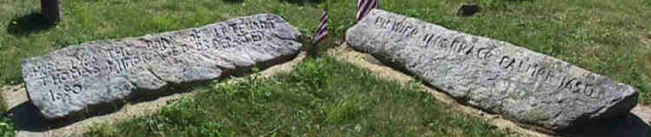
The first organization of the Associate Reformed, later United
Presbyterian denomination, in Crawford County, was effected with ten members in Shenango Township in 1801, by Rev. Daniel MeLean, who, in 1802, was installed its pastor in connection with Sandy and Salem Churches, Mercer County. This pastorate was continued fifty-four years, and was terminated in April, 1854, only three months previous to Rev. McLeans death, in his eighty-fourth year. He possessed unquestioned devotion to the ministry and strong mental and physical powers. The first services of this congregation were held under a tent near the graveyard, and about 1805 a log building was erected in which to worship. In 1818 a second house was built. It was the first frame building in the township. Its furniture consisted of a high narrow pulpit and large square pews with straight backs. The walls and ceiling were unplastered and the interior undefiled by the painters brush. It was occupied until 1879 when a handsome frame edifice, 35×60, was erected on the same site, near the center of Tract 797.

CONNEAUT TOWNSHIP of Crawford County was organized 9 Jul 1800, with the following boundaries: “Beginning at the northeast corner of Shenango Township; thence northwardly the breadth of eleven full tracts; thence westwardly the length of eight tracts, together with the breadth of one tract, to the western boundary of the State; thence by the same northwardly to the northwest corner of Shenango Township, thence by the same to the place of beginning.” As thus constituted it was the middle one of the three original western townships of Crawford County. and included the south half of present Conneaut, the southwest corner of Summerhill, the western part of Summit and Sadsbury, all of Pine and most of North Shenango. By a re-formation of township lines, in 1829, Conneaut was reduced to its present limits. It is situated on the western line of the county, and is bounded on the north by Beaver and Spring Townships, on the east by Summerhill and Summit, and on the south by Pine and North Shenango.
Conneaut was the Indian term applied to the lake in Sadsbury Towaship. It signifies “The Snow Place,” and was so called, it is supposed, from the fact that the snow on the frozen lake lingered long after it had disappeared from the surrounding land. Though the lake was not within the original bounds of Conneaut Township, the latter doubtless received its name from this body of water, or from Conneaut Creek.
The surface is level or gently rolling. Paden Creek flows southward through the western part, and Mill Creek through the eastern part, both entering Shenango Creek in Pine Township. Along the streams the soil is a gravelly loam, and beyond it is generally a clay. It produces good grass and grain; and dairving and stock-raising form the chief vocations of the people. Red and white oak, beech, hickory and other varieties of timber densely coy. ered the surface. Hemlock grew in the southwest part.
Its area is 24,492 acres. The population in 1850 was 1,807; in 1860, 1,867; in 1870, 1,729, and in 1880, 1,601. The population of the original township in 1820 was 562.
Except a narrow strip along the western line, which was owned by the American Land Company, the township was included within the domain of the Pennsylvania Population Company. The agent of this latter company was Jabez Colt, who, in order to stimulate immigration to these lands, in the summer of 1797, or earlier, engaged the services of a half dozen or more sturdy, young, unmarried immigrants and made an improvement called Colt’s Station, in the eastern part of the township, and probably at the south end of the dividing line, between Tracts 710 and 711, or in Tract 715. For several years they remained here, but the place did not flourish and the land agent abandoned the settlement and made another improvement in what is now Pine Township.

Conneault Township Map
The following statement shows the condition of the Population tracts in 1812, when the company closed its business-the number of the tract, name of settler, date of contract, number of acres, contracted for and its final disposition. Each tract contains an area slightly exceeding 400 acres. Tracts 706 and 707, William L LATTA, April 27, 1805, 100 acres each, settled under contract.
The following were tax-paying residents of the township in 1810: Alexander JOHNSTON, William and Samuel LATTA, Robert Martin, John Parr, Samuel Potter, William and Samuel Rankin, Samuel Brooks, Thomas Crockett, Henry Frey, Obed Garwood, William Hill, Thomas McGuire and Rebecca Paden. Alexander Johnson was a native of Ireland, and settled on Tract 687, in the northeast corner of the township, where he remained till death, leaving five children: William, John, Mary (Lopeman), Jane (McDowell) and Esther (Crockett). William Latta, also a native of the Emerald Isle, was a hatter, settled near Penn Line and after a few years removed from the township. His brothers, Samuel, John and Thomas, were also here, and made improvements, then departed

Shenango River Watershed originates in a large wetland area in Conneaut Township, Crawford County
The large number of abandonments and assignments are particularly noticeable in this township. Pioneer privations were severe and continuous. The labor of clearing the timber was extremely arduous, and the soil was often found too low and wet to produce crops. In consequence, most of those who settled here either sold their claims for the small price they would command or abandoned them entirely and left the country. Difficulties with the Land Company also arose, and increased the discontent and emigration. Many were without means, but did not remove until they were literally starved out. In more than one instance planted potatoes were dug up and greedily devoured by these primitive settlers.
Rock Bluff City, Cass County , Nebraska
Rock Bluff was a pioneer crossing on the Missouri River. Settled in 1854 by a German named Benedict Spires, Rock Bluffs became a leading point for equipping freighting outfits to cross the plains during the 1850s. By 1877 it had almost 200 residents, as well as a Methodist Church, a post office, a mayor, the county fair, a common lodge hall for Masons and Odd Fellows, and a variety of businesses including three stores, two blacksmith shops, two saloons and a billiard hall. There was a race track near the steamboat landing, and a coal mine south of town. Rock Bluff once competed with Plattsmouth the be the county seat of Cass County.
1854 – The area had been settled. The village was located in Cass County on the Missouri River about four miles east and one mile north of Murray, Nebraska, in section 9, township 10N, range 14E. Its growth was dependent on steamboat travel along the river and developed along with the river trade. Rock Bluffs was a leading point for equipping freighting outfits to cross the plains during the 1850s.

- Plattsmouth and Cass County Nebraska
In 1854, fifty one towns were organized in Cass County which were later abandoned. Rock Bluff City was one of these towns; its post office was discontinued in 1904. One theory for Rock Bluff’s demise is that the town was adversely affected when Plattsmouth secured the Burlington railroad.
10 Jun 1856 – Organized as a village. So named because of the rocky character of the banks of the Missouri River there, On November 3, 1858, Rock Bluffs and North Rock Bluff were incorporated by the Nebraska legislature as Rock Bluff City. A newspaper, the Cass County Sentinel, was begun at Rock Bluff City but was moved to Plattsmouth in 1859. Rock Bluff vied with Plattsmouth for county seat in the 1860s. By 1877 it had 175 inhabitants, two trading houses, a mill, a blacksmith shop, a methodist church, and a post office which had been established March 12, 1857. The Naomi Institute was organized here in 1870 and ran for three years. The building was later occupied by a local school district.
1866 – Perhaps the most notable incident in the town’s history was that involving a ballot box that “went to dinner.” During the referendum of 1866 Nebraska voters were deciding whether the territory should become a state, and if statehood was achieved, whether the first officers would be Republicans or Democrats. David Butler headed the Republican ticket and J. Sterling Morton the Democratic one.
The political parties were almost evenly divided in Nebraska Territory, and the election was close. In the precinct of Rock Bluff, Cass County, 107 votes were cast for the Democrats, more that twice as many as for the Republicans, and enough to put Cass County in the Democratic column. However, the county canvassers decided that because the ballot box had been taken to the home of one of the election officials over the noon hour, when the polls were declared closed, all Rock Bluff precinct votes would have to be thrown out. The same hour recess was taken that evening. The reasons alleged by the county board for suppressing the vote of Rock Bluffs were “fraud, irregularity in adjourning the polls at noon and evening, and the fact that the poll book and tally sheet were not separately certified.”
The result was that Cass County went Republican, and its representatives furnished the edge in the legislature that enabled the Republicans to elect Nebraska’s first two United States senators, John W. Thayer and Thomas W. Tipton. Democrats protested in vain that the two adjournments by the election board were technical irregularities only, and did not justify disallowing the Rock Bluff Precinct votes.
Because of this celebrated case, Rock Bluff achieved a permanent place in Nebraska’s political history. However, when the railroad came through Omaha, Rock Bluff went into a serious decline. Today it is a ghost town.
1870 – Naomi Institute also known as the Rock Bluff School, is located in the ghost town of Rock Bluff, Nebraska, three miles east of Murray. It was one of the earliest higher education institutions in Nebraska, founded in 1870 as a pioneer college. The building was listed on the National Register of Historic Places in 1977.

Rock Bluff School, Nebraska
Originally a two-story structure in Rock Bluff, Nebraska, today the one-story brick school is all that remains of a ghost town. Rock Bluff was a popular crossing on the Missouri River, and had a post office, a mayor, the county fair, a common lodge hall for Masons and Odd Fellows, and a variety of businesses including three stores, two blacksmith shops, two saloons and a billiard hall. There was a race track near the steamboat landing, and a coal mine south of town.
Joseph Diven Patterson secured a lot overlooking the Rock and Squaw creeks of the Missouri River bluffs in order to establish a school in 1870. He built a two-story building that was 25 feet by 50 feet in size for $3,500. On 1 Sep, 1870 the Naomi Institute opened. Advertisements for the Institute reported that “the morals of the place are the very best there is, not a dramshop in the village, and the pupil will be free from the surroundings of vice that are usually found in larger and ‘faster’ towns in the West.” The Naomi Institute was regarded as one of the leading educational institutions in Nebraska, and was the first higher education institution in Cass County.
After opening successfully, the school’s debt forced Patterson to sell the building in 1872. It later served as the Rock Bluffs School.
After a railroad bridge was built in Omaha in the 1870s the town of Rock Bluff lost its importance, which was only exacerbated when the closest railroad tracks were built ten miles west. The town was completely abandoned by the 1940s.
Red Bluff, Montana
Josiah Harvey FOSTER’s daughter Jeanette was born 14 Apr 1832
in New York.
In the 1860 census, Jeanette and her husband Charles Bradley were farming in Arlington, Columbia, Wisconsin.
They moved to Montana Territory where their son John J. Bradley was born about 1866. In the 1870 census, Charles and Jeanette were farming near Virginia City, Montana.
In 1863, the area around Virginia City was part of the Dakota Territory until March, when it became part of the newly formed Idaho Territory. On May 26, 1864, the Territory of Montana was formed, with Bannack briefly becoming the territorial capital, Virginia City would quickly take that title from Bannack.
In May 1863, a group of prospectors were headed towards the Yellowstone River and instead came upon a party of the Crow tribe and were forced to return to Bannack. Gold was discovered on the retreat trip when Bill Fairweather stuck a pick near Alder Creek joking he might find something to fund some tobacco.
The prospectors could not keep the site a secret. They were followed on their return to the gold bearing site and set up the town in order to formulate rules about individual gold claims. On June 16, 1863 under the name of “Verina” the township was formed a mile south of the gold fields. The name was meant to honor Varina Howell Davis, first and only First Lady of the Confederate States of America during the American Civil War. Verina, although in Union territory, was founded by men whose loyalties were thoroughly Confederate. Upon registration of the name, a Connecticut judge, G. G. Bissell, objected to their choice and recorded it as Virginia City.
Within weeks Virginia City was a veritable boomtown of thousands in the midst of a gold rush with no law enforcement whatsoever, except for vigilantism. Most of Montana became under the rule of a Vigilance committee, the infamous Montana Vigilantes, which operated on both sides of the law. Their secret motto, 3-7-77 is still on the badges, patches, and car door insignia of the Montana Highway Patrol.
In 1864, the Montana Territory was carved out of Idaho Territory. Virginia City, claiming 10,000 citizens, was made the capital of the new territory in 1865. The first public school was built in 1866, but already the most easily accessible gold from placer mining had been exploited and development and population in the territory was moving towards Helena.
In the 1880 census, Jeanette was widowed and keeping a hotel in Red Bluff, Madison, Montana. (About 30 miles north of Virginia City and 30 miles south of Bozeman on Montana State Route 84.)
Red Bluff was settled in 1864 as a mining town and stage stop on the Bozeman road. During it’s hey day, Red Bluff had two gold mills, various stores, businesses and 12 saloons. The town existed with it’s school and post office until 1890 when the railroad came to the Alex Norris Ranch three miles to the west.

Red Bluff Montana Historic Sign

Red Bluff Tanners Hotel & Livery stable
Could this have been Jeannette’s hotel? I haven’t found out, but a clue is Bradley Creek Road is the main highway running south from Red Bluff. The Tanner brother initials were A.W. and C.E.

The Red Bluff Tanners Hotel & Livery stable was destroyed by Fire in 2006

Red Bluff Cemetery – Notice the “green” countryside of May & June compared to the “yellow-wheat” color of the other ten months of the year.
Today Red Bluff is a Montana State University Research Ranch located near Norris in Madison County, Montana, along the west side of the Madison River.
Gilt Edge, Montana
When Howard Irwin SHAW’s father died, the family moved to Bozeman, Montana where Howard was a member of the first class at Montana State College. After his education as a mining engineer, he went to work at the mines in Gilt Edge where he met Nellie who was visiting her sister Eleanor. They drove in a blizzard to Lewistown to be married on 4 Mar 1899.
Gilt Edge, Montana, is not just another mining camp, ghost town. It is an abandoned mining camp with a history unlike any other. To start with, the name can be spelled two different ways. Some spell it as one word: Giltedge; while others use two words: Gilt Edge. Both spellings were correct and used during the life of the camp.

Gilt Edge Poverty Hollow 1900

Gilt Edge Today
But the spelling issue is not the main historic significance of Gilt Edge, Montana. Two other facts are. First, Gilt Edge was the first place in the entire USA to use the cyanide leeching process in gold mining. Some disagree and say that Gilt Edge was the 2nd, next to Mercer Utah, but most agree the Gilt Edge was the first.

The Cyanide Mill of the Gilt Edge Company

The new Gilt Edge Cyanide Mill 1899
The second fact is, while the new Gilt Edge Cyanide Mill produced gold in abundance-instantly and regularly-it was a financial flop for the first six years. And the new and adjacent mining camp of Gilt Edge paid the price. Rather than boom, it was up and down and bust for the first six years! The Gilt Edge Mill and the adjacent town started in 1893, just when the United States was at the depths of a very severe economic depression. As such, all eyes in the national financial and international mining world turned to Gilt Edge, in Fergus County Montana, and observed! For if Gilt Edge produced successfully, investors could easily be persuaded to invest in cyanide plants in other mining areas-and that would help end the depression.

Gilt Edge Whorehouse
Things were so economically strapped in Fergus County in 1893 that in Lewistown, the new county seat, few if any could afford the price of a theatre ticket. A group of community players was thus formed to provide free entertainment at the Culver Opera House. Indeed, the people of Fergus County also watched the week by week reports of the new Gilt Edge Cyanide plant-as published by the FERGUS COUNTY ARGUS-for with its success, better times would be seen in central Montana.
The saga of Robert A. “Honest Bob” Ammon, the New York lawyer who moved to Fergus Coun ty and became the “resident manager” of the new Gilt Edge Mine and Mill, explains why Gilt Edge produced gold bricks in abundance, yet was a financial flop for the first six years. It took six years to get rid of “Honest Bob”. After Ammon hoarded the gold, and finally ran off with it in 1894, the mill eventually reopened under new management. Optimism prevailed-but again, Ammon somehow gained control. This process repeated itself several times, until in 1898, when the courts gave total control to new management. Then the mill produced, the bills were paid, stockholders made money, and the town of Gilt Edge prospered and grew.
Howard Irwin Shaw, Alex’s great-great grandfather was hired to get the Cyanide Mill running (an early defiler of the environment.)
Gilt Edge, Montana, is not just another mining camp, ghost town. It is an abandoned mining camp with a history unlike any other. To start with, the name can be spelled two different ways. Some spell it as one word: Giltedge; while others use two words: Gilt Edge. Both spellings were correct and used during the life of the camp. But the spelling issue is not the main historic significance of Gilt Edge, Montana. Two other facts are. First, Gilt Edge was the first place in the entire USA to use the cyanide leeching process in gold mining. Some disagree and say that Gilt Edge was the 2nd, next to Mercer Utah, but most agree the Gilt Edge was the first. The second fact is, while the new Gilt Edge Cyanide Mill produced gold in abundance-instantly and regularly-it was a financial flop for the first six years. And the new and adjacent mining camp of Gilt Edge paid the price. Rather than boom, it was up and down and bust for the first six years! The Gilt Edge Mill and the adjacent town started in 1893, just when the United States was at the depths of a very severe economic depression. As such, all eyes in the national financial and international mining world turned to Gilt Edge, in Fergus County Montana, and observed! For if Gilt Edge produced successfully, investors could easily be persuaded to invest in cyanide plants in other mining areas-and that would help end the depression.

Gilt Edge Map
Things were so economically strapped in Fergus County in 1893 that in Lewistown, the new county seat, few if any could afford the price of a theatre ticket. A group of community players was thus formed to provide free entertainment at the Culver Opera House. Indeed, the people of Fergus County also watched the week by week reports of the new Gilt Edge Cyanide plant-as published by the FERGUS COUNTY ARGUS-for with its success, better times would be seen in central Montana.
Sources:
http://history.rays-place.com/pa/conneaut-pa.htm

Pingback: Philo Sidney Miner Jr. | Miner Descent
Pingback: Favorite Posts | Miner Descent
Pingback: Howard Irwin Shaw | Miner Descent
Pingback: Robert McConaha Latta | Miner Descent
Pingback: College Graduates | Miner Descent
Pingback: Favorite Posts 2011 | Miner Descent
Pingback: Fay Everett Miner | Miner Descent
On the map of Gilt Edge, on Main St, between 3rd and 4th there is a square labeled Caraway’s General Store. That was my great grandfather Vincent Caraway. Note Calamity Jane’s house, in the lower right hand corner of the map.
We have a little family story about Calamity Jane. Everyone in Gilt Edge was excited that a celebrity had come to town, but of course proper women were not frequenters of the saloon. My great grandmother has to see, and she peaked in the window. Calamity Jane spied her and exclaimed “We don’t like no rubber neckers!” And I assume my g-grandma ran home quickly. I heard the story when I was very small and have always been able to visualize clearly.
All the best, Mark